Nazca-Linien
Bildinfo und Lizenz
© 2016
- 2026
Basiswissen|
Fakten zu den Nazsca-Linien|
Wie könnten die Figuren gemacht sein?|
Wie alt sind die Figuren?|
Wozu dienten die Figuren?|
Ein Selbstversuch: die gerade Linie|
Was ist die Prä-Astronautik?|
Fußnoten
Bildinfo
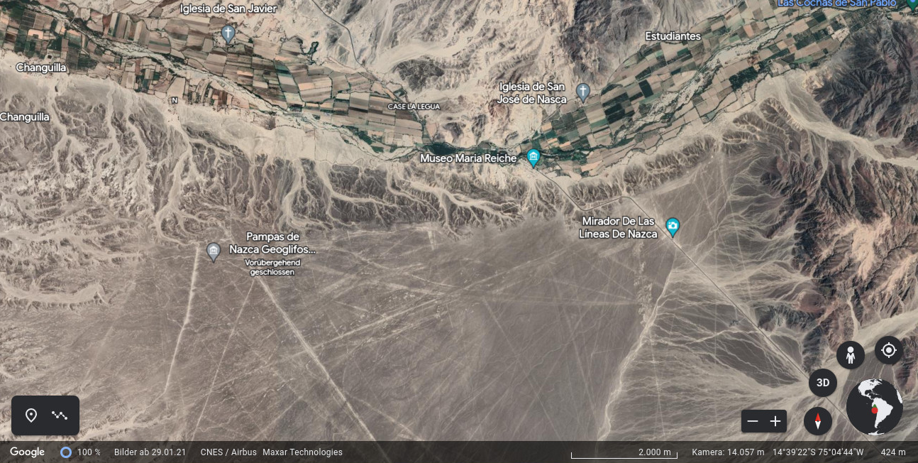
- Die vielen geraden Linien und die langgezogenen Dreiecke in dem Bild wurden von prähistorischen Kulturen in Peru angelebt. Zum Größenvergleich sieht man oben im Bild ein fruchtbares Flusstal mit rechteckigen begrünten Landwirtschaftsflächen.
Source
- Author: Ansicht aus Google Earth, 2023
- Date: March 26th, 2023
License
- Auszug des originalen Google-Lizenz-Textes vom 31. März 2020: "As long as you follow these Terms, the Google Terms of Service give you a license to use Google Maps/Google Earth, including features that allow you to: view and annotate maps; create KML files and map layers; and publicly display content with proper attribution online, in video, and in print ... " Quelle: https://www.google.com/intl/en-US/help/terms_maps
- Auszug des originalen Google-Lizenz-Textes vom 28. März 2020: "Subject to your compliance with this Agreement's terms, Google grants you a non-exclusive, non-transferable license to use Google Maps/Google Earth, including features that allow you to: view and annotate maps; create KML files and map layers; publicly display Content with proper attribution online, in video, and in print ... " Quelle: https://www.google.com/intl/en-US/help/terms_maps
Warranty
- No guarantee can be given as to the correctness of facts implied or explicitly stated.
- Usage is completey at your own risk. 💣
Originalseite
- Das Bild ist Teil eines online-Lexikons.
- Rhetos Lernlexikon Mathematik, Aachen:
- Siehe unter 👉 Nazca-Linien