 Aus einer kugeligen Erde zweidimensionale Karten machen: eine Aufgabe der sphärischen Geometrie
© Unknown => Zurück zum Artikel
Aus einer kugeligen Erde zweidimensionale Karten machen: eine Aufgabe der sphärischen Geometrie
© Unknown => Zurück zum Artikel
Sphärische Geometrie
Bildinfo und Lizenz
Bildinfo
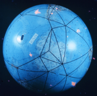
- Aus einer kugeligen Erde zweidimensionale Karten machen: eine Aufgabe der sphärischen Geometrie
- NOAA-Description: A global model of the satellite triangulation network.
Source
- Date: Not later than the year 2018
- Author: Unknown
- Credit: NOAA
License
Images in the NOAA Photo Library are in the public domain and cannot be copyrighted. There is no fee for downloading any images on the site. Educational use is encouraged as the primary goal of the NOAA Photo Library is to help all understand our oceans and atmosphere.
Originalseite
- Das Bild ist Teil eines online-Lexikons.
- Rhetos Lernlexikon Mathematik, Aachen:
- Siehe unter => Sphärische Geometrie